
Saraburi Gr
Type Locality and Naming
Successions (upward; generalized): (1) Khorat Plateau = Si That Fm, Nam Duk Fm, Pha Nok Khao Fm, Hua Na Kham Fm; (2) Loei-Phetchabun Range (Saraburi region of southern part) = Phu Phe Fm (and coeval Tak Fa Fm), coeval Khao Khwang Fm, Khao Khad Fm, Pang Asok Fm and Nong Pong Fm, Sap Bon Fm; (3) Loei-Phetchabun Range (Loei region of northern part) = Wang Saphung Fm, Nam Mahoran Fm (and coeval Huai Som Fm), E-Lert Fm (and upper part is coeval with Pha Nok Khao Fm), Pha Dua Fm (and coeval Hua Na Kham Fm).
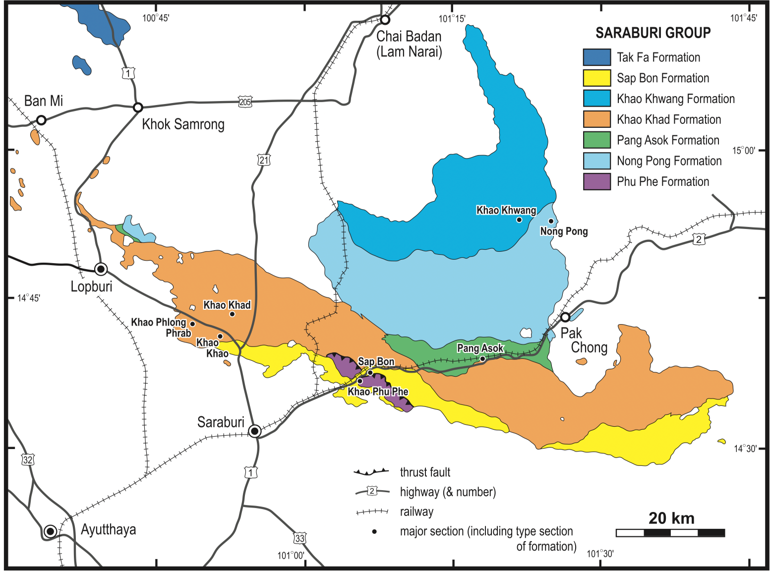
[Figure: Geological map of Saraburi Group in Saraburi area, NE Thailand (Ueno and Charoentitirat, 2011).]
Synonym: กลุม่หินสระบุร
Lithology and Thickness
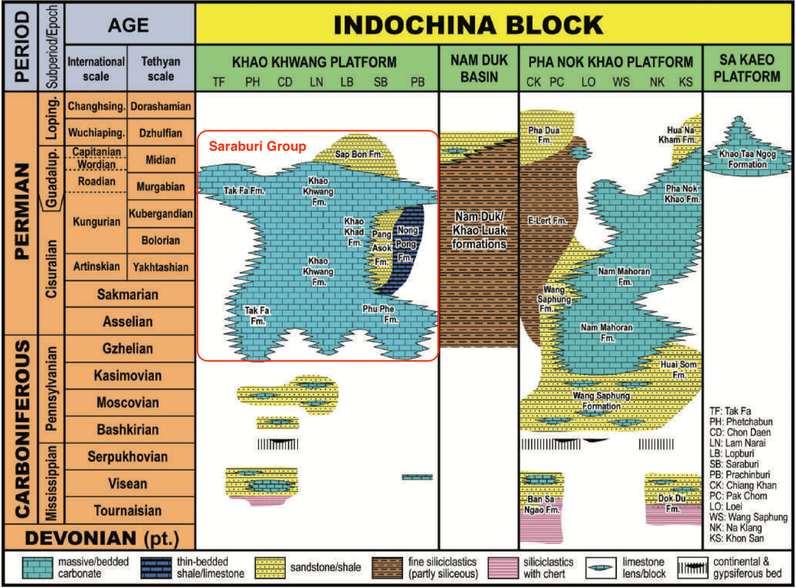
[Figure: Carboniferous and Permian facies distribution and resultant stratigraphic subdivisions on the western margin of the Indochina Block, with Saraburi Group highlighted (Ueno and Charoentitirat, 2011).]
Relationships and Distribution
Lower contact
Upper contact
Regional extent
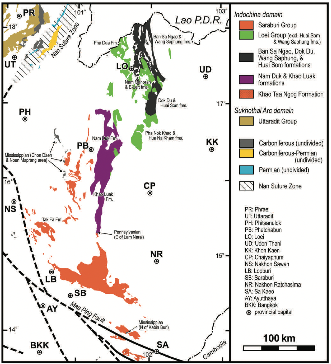
[Figure: Distribution of Carboniferous and Permian in NE Thailand. Data mainly based on 1:1 million scale geological map of Thailand (DMR 1999) with minor modifications (Ueno and Charoentitirat 2011).] [Geo-JSON omitted here to avoid overlap with component formations.]
GeoJSON
Fossils
Age
Depositional setting
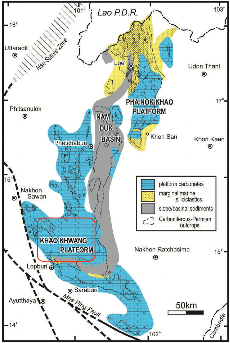
[Figure: Late Paleozoic major facies subdivisions on the western margin of the Indochina Block by Ueno and Charoentitirat (2011). (Slightly modified from Wielchowsky & Young 1985).]
Additional Information
Subdivisions vary among authors and regions:
Six formal formations (Hinthong and others, 1985): Phu Phe Fm, Khao Khwang Fm, Nong Pong Fm, Pang Asok Fm, Khao Khad Fm and Sap Bon Fm;
Two formations by Nakornsri (1977): Khao Luak Fm and Tak Fa Fm;
Three formations by Chonglakmani and Sattayarak (1984): Pha Nok Khao Fm, Nam Duk Fm and Hua Na Kham Fm;
Three formations by Charoenprawat and others (1984): Nam Mahoran Fm, ELert Fm, and Pha Dua Fm.